 |
| Dormition Abbey |
Well, its been another fantastic day in the Holy
City! We departed on an "Old Testament Jerusalem Walk" this morning.
Today we took the southern route to the city through the Zion Gate. We winded
around the Dormition Church on present Mt. Zion to the gate. Here one can see
the bullet holes from the 1967 war. Up until that time the Old City had largely
been in the hands of the Jordanians. Here we passed another portion of the old
Cardo / Roman Road before arriving at our first destination within the city.
Throughout the centuries, Jerusalem's wall have been built, torn down, added
to, and moved. Presently the Old City Jerusalem has been expanded much farther
north than in the days of Christ, and City of David and the original Jebusite
City are now outside the southern wall. Before reconstruction began after the
War of 1967, archeologists had a chance to do some excavations within the
Jewish Quarter. In the 1970s archeologist Avigad discovered the remnants of an
old city wall. This wall has been dated to the reign of King Hezekiah. After
Northern Israel fell in 722 BC, Jerusalem had an influx of "brother"
refugees. Previously the city walls had only been around the Temple Mount and
the City of David (directly south of the Temple Mount). With word that
Sennacherib of the Assyrians was going to be coming against Jerusalem, he
decided to encompass present Mt. Zion and the Western Hill. The work was to be
done speedily, so it was ordered to tear down the houses to build the wall. (Isaiah
22:10) Sennacherib and his men were known for their brutality. They would skin
men alive and impale them on stakes. - Quite the motivation to get a wall up!
When looking the wall, it appears to have been made hastily - just as the Bible
describes. Large stones were placed on the outside, and the interior was filled
with rubble. Remnants of the broken down homes are still visible. Prior to this
discovery, many had maintained that Jerusalem was not as the Bible described, a
great city, but rather a very small, insignificant town. However, with the
discovery of Hezekiah's wall, it was now confirmed that Jerusalem was a city of
no small means.
 |
| That's were we're headed! |
Next we returned southward and exited the city near the
Temple Mount at Dung Gate. Every ancient city would have had a "Dung
Gate" – even if it wasn't called that in particular. The Dung Gate is
lowest gate in elevation. Therefore, it would be out of this gate that all of
one's garbage would eventually flow. Once outside the Dung Gate, one enters
into the City of David. This would have been ancient Jerusalem in the days of
King David and Solomon. Upon entering the City of David Park, we headed up to
an overlook of Kidron Valley. From here, one may view the southern side of the
old city, the Kidron Valley, Hinnom Valley, and the Mount of Olives. This is
where ancient Jerusalem was located – predating David by a thousand years. Surrounded
by mountains, one can feel the "bowl" in which Jerusalem sits. Why did
the Jebusites not begin Jerusalem on a higher surrounding hill? It all boils down
to water. The only source of water in the area is the Gihon Spring, located
down in the valley. Here is their life
source, but we will be getting a close "feel" of the spring in a
moment. Here Jerusalem is defendable and far enough from the Water Ridge /
Patriarchal highway that most would choose to leave them alone. From here one
can see the spot where tradition holds that Abraham was about to sacrifice
Isaac, the same land that David would later buy from Araunah the Jebusite. There
is some doubt if Abraham really did bring Isaac up to the traditional sight. If
he did, Abraham would have been in view of the Jebusite city; not the most secluded
spot for the sacrifice, but perhaps Abraham's previous encounter with Melchizedek
would have allowed him access to the mountain.
Next we headed back down and around to David's
Palace. David built his palace high on the mountain. Here one has a great
overlook of the city. The wealthier one was the higher in elevation one lived.
This way they could catch the breeze. Otherwise, things can get a little sticky
in the valley. The same holds true today. The Jews own the water ridge (where
King David's Hotel is located), and predominantly Palestinians live in the
valley. Just below King David's Palace are a few wealthier homes from the
destruction of Jerusalem by the Babylonians in 586 BC. The burn layers from the
destruction measured up to three feet. These seem to have been quite
sophisticated homes – even indoor plumbing! When the Babylonians came, they
deported the wealthy and nobility into exile. They left the poor to manage the
land so that they could be taxed in order to bring in more wealth to the
empire.
 |
Here we are walking though a tunnel begun by the Jebusites and expanded
in later years. |
Further downhill we entered the shaft to descend
into Hezekiah's tunnel. Once near the mouth of the spring, we would have been
just outside the old city. This posed a problem in Biblical days. Although
fortresses had been built to help guarantee access to the well during times of
war, it would be far better to have the spring inside the city. This is exactly
what Hezekiah set out to do. How they did it, we are not sure. One team started
on the inside and the other on the out. Somehow, through many curves, they
managed to meet and connect their tunnels. This new water feed now brought
fresh water inside the city to the Pool of Siloam. It was here that Jesus sent
the blind man from birth in order to complete his healing. This certainly
caught the attention of the Jewish leaders. Never before had a man been born
blind been able to see – this was one of the Old Testament signs of the
Messiah. No wonder it caused quite a stir beyond the miracle itself. Only part
of the pool of Siloam has been excavated as the remainder sits on a church's
private property. The pool was discovered while digging for a sewage line
(which can be seen behind). We then proceeded back up the hill through the
ancient escape route / sewage line. It was here in these tunnels that many
attempted to hid during the destruction of Jerusalem in 70 AD. However, the
Romans did find them and had them deported.
Back up in the City of David we took a moment to
look at some excavations from the Roman period before heading back to campus.
Although we are seeing a lot, there is little time to stop and take in the
scenes as much as we would prefer. It is not a "tour group," but an
educational class. It is bittersweet. I would like to have more time to soak in
each place, but then there would not be time to see everything. … and boy do we
have a packed schedule: only two and a half days off in the next three weeks! I
will have to decided very carefully what other sites I want to try to fit in.
After lunch we had another lecture series. This time on local geology and the way of life in Israel. It's fascinating how geology plays so significantly into how and where the nation developed as well as the peculiarities of Jerusalem. But those stories will have to wait for another time. :)
 |
Walking up Modern Mount Zion to Dormition Abbey, overlooking the
city to the South. |
 |
| King David near Dormition Abbey |
 |
| Zion Gate |
 |
| Notice all the Bullet Holes from the 1967 War. |
 |
| In the Jewish Quarter :) |
 |
| View of Street |
 |
| Another Portion of the Second Cardo (Roman Road through Jerusalem) |
 |
This is part of the Wall Built by Hezekaih before
Sennacherib invaded. Notice the unevenness of its
structure. This testifies to its speedy construction. |
 |
According to Isaiah, King Hezekiah ordered houses to be broken down in
order to build the wall. Here on the far end you can see remnants of some of
those houses that were being taken apart. |
 |
| Here's a map that helps identify where we are ... the small red semi-circle is the wall you just say. This is part of Hezekaih's wall. Old City Jerusalem in Old Testament Times and in Jesus' day is represented by the dotted line. The walls today are in the black line. As you can see only a small section along the Temple Mount and the west side of the city has remnants of Hezekiah's wall (bottom on this map). Additionally the City of David is now outside the city walls. Apparently when Suleiman I of the Ottoman Empire found out that the builders did not include the city of David and Mt. Zion within the city walls, he had them buried in it! |
 |
| Special Paving Stones mark the location of Hezekiah's Wall |
 |
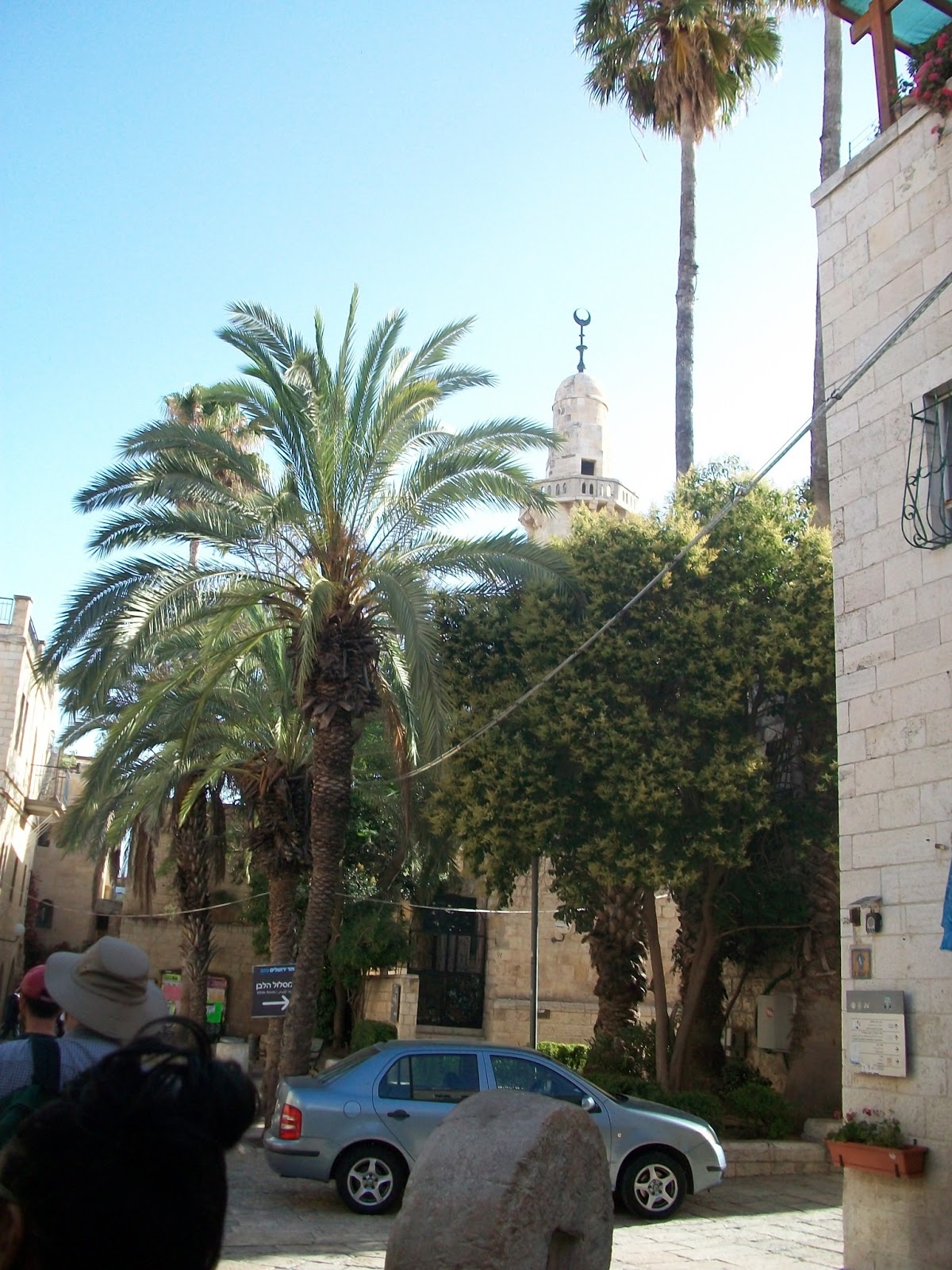
| Walking through Jerusalem |
 |
| Overlooking the Temple Mount |
 |
| Inside the City of David Park |
 |
At lookout in the City of David. Here looking back toward the Temple Mount.
You can just make out the dome of the Al-Aqsa Mosque. |
 |
| Al-Aqsa Mosque from lookout in the City of David |
 |
Looking Back toward Modern Mount Zion. The church in the
distance is Dormition Abbey |
 |
| Looking down the Hinnom Valley |
 |
Notice the caves at the foot of the city ... those are tombs.
(Looking toward Mount of Olives) |
 |
Mount of Olives on Left. Those are all graves! Mount of Olives has been the
cemetery of Jerusalem for thousands of years. Possibly even predating David. |
 |
Looking down toward tour group. Getting ready to discuss
Nehemiah's Wall and the Babylonian Conquest. |
 |
On top of this structure is David's Palace. Pictured are two homes destroyed
in the Babylonian Captivity of 586 BC. That black hole on the right - that's a toilet! |
 |
| Overlooking Hinnom Valley |
 |
| Getting Ready to descend into Hezekiah's Tunnel |
 |
| Making the first descent down to the Spring of Gihon |
 |
| And Yes, I'm really there. |
 |
Here is an artists interpretation as to the base of the spring. These walls
were brought out in order to help prevent their water source from being
cut off by the enemy. |
 |
| Hey look! There are some stalagmites in here :) |
 |
Here we are walking through Hezekiah's Tunnel. Burr!
The water is cold. At its deepest point the water came
above the knees. |
 |
| "Step into the Water" |
 |
| Wow, this is really tall! |
 |
Plaque commemorating this feat. In summary it says that the two teams were
able to meet while digging. They heard each other while three cubits of rock
remained. With the final blow, both men hit each others axe. |
 |
This is the exit point of the tunnel. Pictured is the Byzantine
Pool of Siloam - not the one in Jesus' day. |
 |
Looking down toward the Pool of Siloam (in the distance) to the left is the
sewage line they were digging to install when they discovered the
pool in the 70s or 80s. Notice how far below the present ground level this is!
In some cases up to 60 feet have accumulated since Jesus' day! |
 |
Here is a Widows Mite. Supposedly found here, but I wouldn't take the
Gentleman's word for it. Looks to me like a replica for tourists.
Recall the story of widow and her two mites? (Luke 21) |
 |
Coins supposedly found here. Hadrian on the bottom (130s AD)
and I think it was Constantine on top? |
 |
One Side of the Pool of Siloam. The rest cannot yet be
excavated as it is on church property. |
 |
| That's me at the Pool of Siloam. I Can See!! |
 |
| Original Roman Road. This is in a tunnel on the adjacent side toward the spring. |
 |
Again notice how much has accumulated since the 1st
Century. The light up there is current street level. |
 |
Here is an artists depiction of the Pool of Siloam from
where we arestanding on the Roman Road |
 |
Looking down the hallway at one side of the
road facing the Pool of Siloam. |
 |
| Walking through the ancient sewer system / escape route. |
 |
| Mosaic found in archaeology dig. |
 |
| Again look how far down to the Roman/Byzantium Period |
 |
| Walking back to JUC along the Old Wall |
 |
| Dormition Abbey on Mt. Zion |
 |
| JUC inner courtyard. |
 |
Thought of Grandma when I saw this picture of Jerusalem and
the JUC as it was taken in 1928. So that's what this city looked like
when she was born. |
 |
| Okay test time ... this is Eocene Rock. This is found primarily in the Shephelah. |
 |
Dinner Time ... Haven't taken pictures of my more colorful meals, but they have
been serving us well. (Already ate half the carrots and opted out of their
many salad choices) We have an Arab-Christian Cook, so the food has an
Arab flare. Very good! The white stuff is cauliflower with cheese and some
other stuff. Main dish is Chicken-like stir-fry. |
 |
Okay this is out of order ... but this is the Menorah that is ready for the Third Temple.
I'm hopeing to get a chance to stop by the Temple Institute to see the rest of the
furniture including a replica of the Ark of the Covenant. |
 |
And Again, this is the archaeology site we passed though earlier in the day
before returning to JUC. |


No comments:
Post a Comment